
Section under reconstruction
Contents:
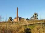
Pleasley Colliery is located in the Nottinghamshire / Derbyshire concealed coalfield which forms part of the eastern limb of the Pennine uplift. It lies about 2 miles (3.2km) east of the boundary with the exposed coalfield.
It sits directly on a bedrock of flaggy yellow-brown dolomitic limestone of the Permian Lower Magnesian Limestone (LML) formation which dips gently north-eastwards. There are no significant drift deposits and rock-head is overlain by a fertile brown soil. The LML is underlain by the Lower Permian Marl (LPM), a grey limey mudstone which outcrops along the river Meden valley where it is marked by numerous spring lines. The Permian rocks thin rapidly to the W before finally fading out in the vicinity of Teversal. About a mile or so to the N, at Glapwell, their termination is marked by a prominent escarpment.
The LML is a major aquifer in this region with high permeability enhanced by substantial fissuring, a factor which contributed to high groundwater inflows during the sinking of the shafts.
The base of the Permian lies unconformably on Westphalian Middle and Lower Coal Measures (MCM and LCM) which locally dip at about 1 in 20 to the NE. Immediately to the west of the Permian escarpment, the MCM coal seams outcrop on the flanks of the NW-SE trending sction of the Hardstoft - Mansfield Anticline, where they were worked in shallow mines in the early 19th century.
Unlike at a number of its neighbouring collieries, the coal measures at Pleasley are relatively fault free. Two fault zones running roughly NW-SE have minor splays and en-echalon displacements with maximum throws of about 25 ft. These lie to the W and E of the pit whilst in the Top Hard seam large washouts trending NNE-SSW lie to the NW. The cleat runs at roughly NW-SE following the trend of the anticline to the west.
The faulting in the coal measures predates the Permian and there is no indication of any subsequent post-Carboniferous movement. There is some suggestion, however, that the fissuring in the Magnesian Limestone seen in this area has been influenced by the structural trends in the underlying coal measure.
Copyright © 2023 J.S. Thatcher
Page updated on:
31 Dec, 2025
In case of problems contact:
at
07:42:50 PM